
 turismoa@zumaia.eus
 Bulegoa


The Bedua meander and islands
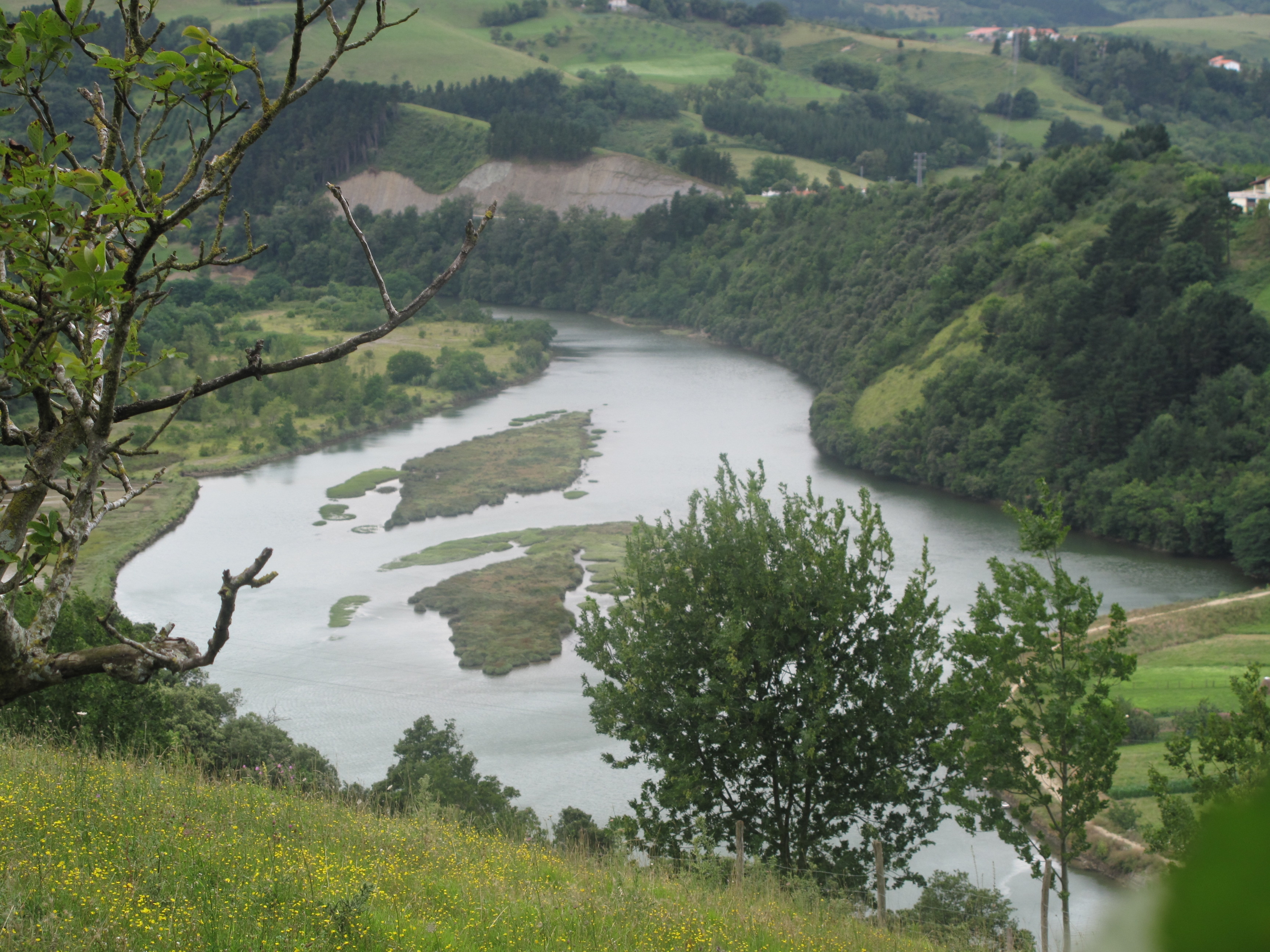
The Bedua meander
The Bedua meander is located at the end of the Urola estuary, on the outskirts of Zumaia. After passing Oikia and flowing through an open valley, the river suddenly encounters a more abrupt landscape and is channelled between two hills with sharply sloping sides. The left bank is occupied at first by vegetable gardens, and then later by woodland and thickets. During the mid nineteen-seventies, the right bank was filled in and a large open area created next to the river. It is a part of the estuary in which the movement of the tides and the materials brought downstream by the river itself have created a unique ecosystem supporting several interesting botanical and animal communities.
Bedua islands
Traditionally, these flat, fertile plains have been used for crop farming and industrialisation, and much of the wetland areas have been drained. As a result, the majority of the wetland species have disappeared from the Urola estuary.
Flora and fauna
Despite their small size, the islets are nevertheless is a very good state of conservation. The area is also home to a number of rare species typical of well-preserved wetland areas. The stretch of river closest to Oikia is not heavily influenced by the tides and supports many riverside plants, including alders and plane trees, as well as several smaller species.
The birdlife in Bedua is very similar to that found in the Santiago area, since the proximity and similar characteristics of the two areas enable birds to move easily from one to the other.