Urban walks
Zumaia, Estuary and Sea
This walk takes you around the cliffs closest to Zumaia. Up until quite recently, these geological treasures, which reveal all sorts of intriguing secrets, were only known about by geology experts who travelled from far and wide to visit them. It is best to do this walk at low tide so that you can see the large wave cut platform that becomes visible when the tide is out. This walk sets off from Zumaia and goes up Talaimendi hill, the town’s old lookout point which was used, like other lookout points along the Basque coastline, to spot whales and keep the town informed about what was going on along the coast since the Middle Ages. The walk then continues along beside the cliffs on Itzurun beach until it reaches Algorri point. One of the most eye-catching features of this walk is the structure of the rocks, a formation known as flysch, which consists of alternating hard and soft layers (strata of sandstone and shale) which were deposited on the sea bed millions of years ago. Once these layers had been buried and transformed into rock, they were shifted by the Earth’s internal movements, which pushed them up until they were exposed to the erosive action of the sea. The waves act like a knife, cutting the rocky front, shaping a horizontal wave cut platform and creating a vertical cliff-face at the point where they can go no further. At Algorri point, amongst the layers of rock which come to the surface next to the sea, there is a layer which is 65 million years old containing particles belonging to an asteroid which collided with Earth during that period, and which probably caused the fifth mass extinction in the history of life on our planet. There are further two vertical layers next to Itzurun which are now officially-recognised stratotypes used as an international point of reference due to the quality of the outcrops. To find out more about this area and its interesting geological features, the Algorri Interpretation Centre is well worth a visit. You can also take part in one of the guided walks and boat trips which are organised on a regular basis by the tourist office in Zumaia (look at geoparkea.eus).
Length: 6,8 km. (Download KML)
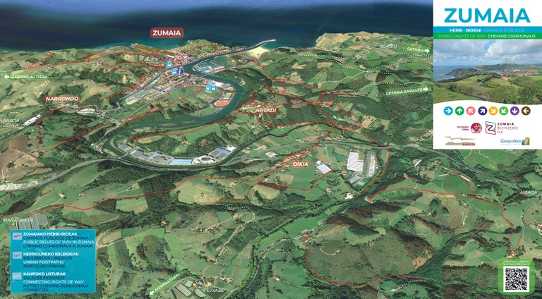
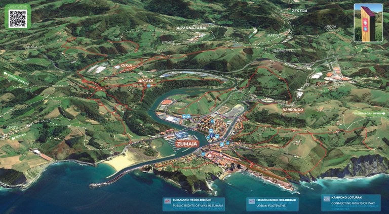
Public rights of way in Zumaia
The Zumaia City Council has recovered and marked out public paths that have historically linked Zumaia with surrounding towns.
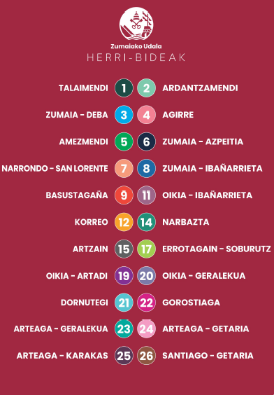
In the map bellow, you will find an inventory of them and you will be able to identify the type of signal you can follow.
The paths of other municipalities that may be a continuation of these are also marked in another color, in order to make longer routes.
You can download here the map in pdf format.
You can download here the list of public rights of way.


 turismoa@zumaia.eus
 Bulegoa


